“Butler County, Kansas, is in the lead in stone arch bridges and culverts and in years to come in this respect its fame will go abroad. The county will have nothing else.”
Walter Sharp, The Kansas City Star, October 4, 1905.
For the aid of those who would like to view the numerous scenic, publicly accessible, vehicular stone arch bridges of Butler County, Kansas, we have compiled a list and color-coded map of the known stone arch bridges and culverts in the county. The bridges are shown on the map with the aid of a number. For aid in reference, on the list below the number we used to depict a given bridge on the map will be clearly stated. At the end of the list mention of a noteworthy private stone bridge is made.
Want to know more about what makes Butler’s stone arch bridges significant? For these details please see our post on The Stone Bridge Legacy of Butler County, Kansas.
Note: Please no trespassing. To the best of our knowledge, the bridges on the list below and the map above are all publicly accessible; in case of any questions or problems feel free to contact us. This list is updated as more bridges turn up.
A List of the Existing Stone Arch Bridges On the Roads of Butler County, Kansas
Please note that the actual bridges (Numbers 1 – 21, spans 20′ or greater) are organized by the size of the waterway, with the largest bridges first. Numbers 22 and up are culverts and not organized by span. The recent discovery of the second largest stone bridge in Butler (Peter Johnson’s Bridge) necessitated a major update in the numbering compared to previous editions of our map and list.
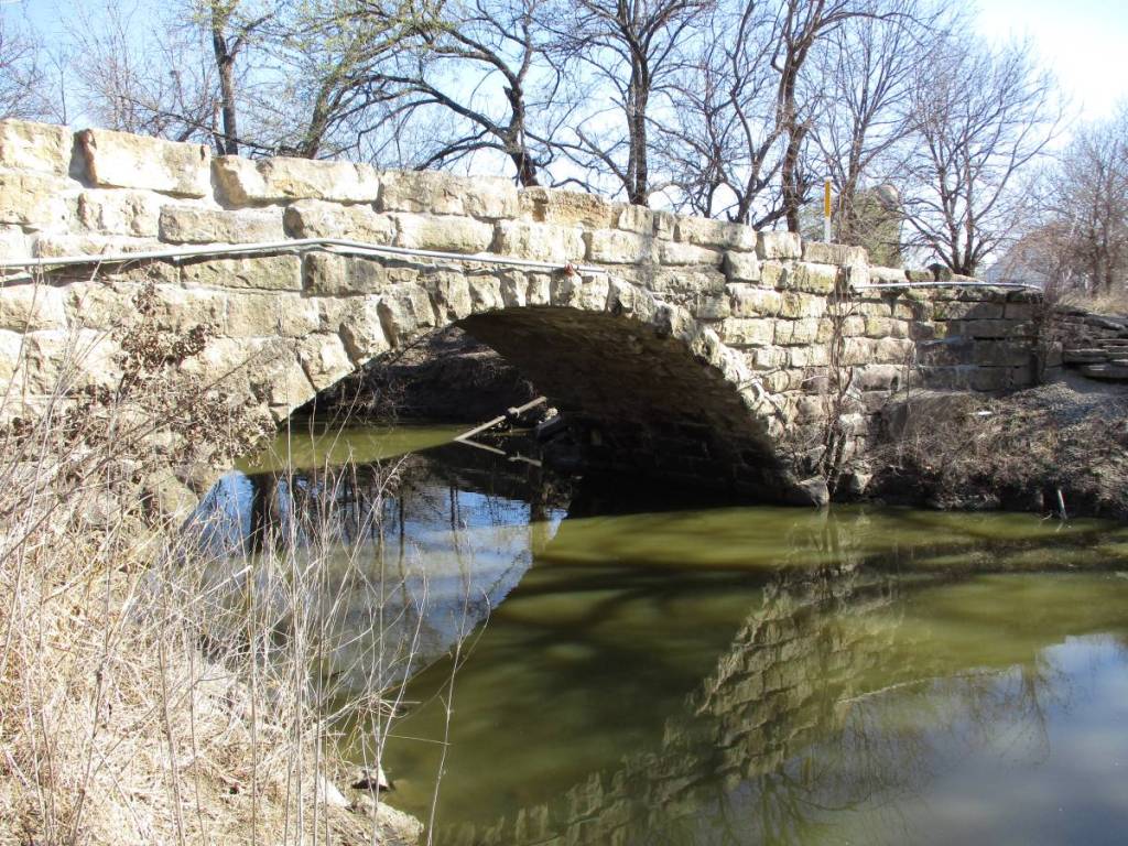
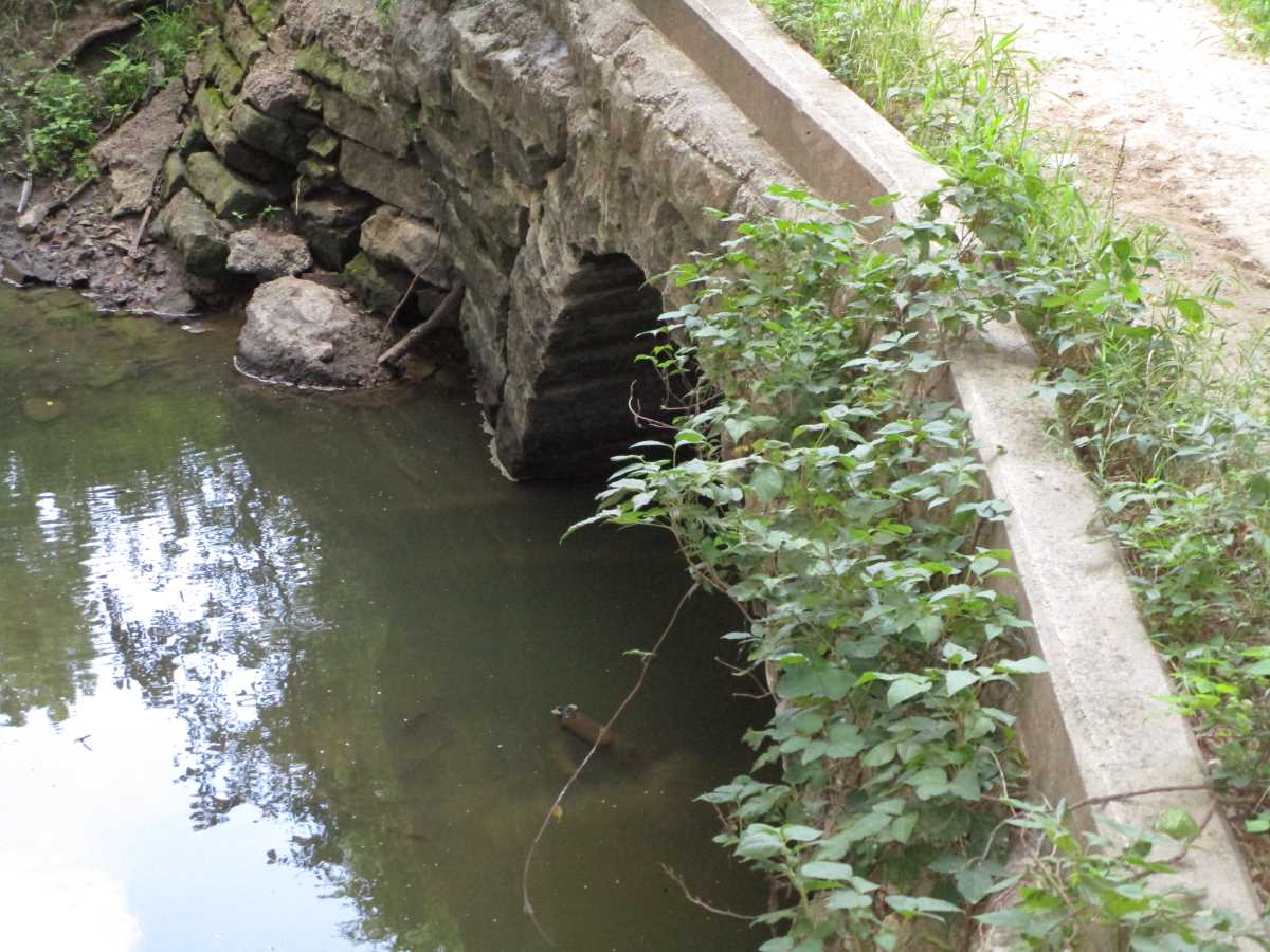
Ellis Bridge
- Where: On NE 110th Street where the road crosses the Walnut River, south and west of Cassoday.
- When: Construction of the original portion began in 1901 and was completed in 1902; bridge received its second full-sized arch in 1906, thereby achieving its final form (minus the cantilevered slab top).
- Builders: Walter Sharp built original section of the bridge. Abe Matheney put the bridge into its final form (minus the cantilevered slab top).
- Spans: Two 36′.
- Further Resources: Cassoday’s Double Arch Walnut River Bridge, Butler’s Three Walnut River Bridges.
- Map Number: 1.

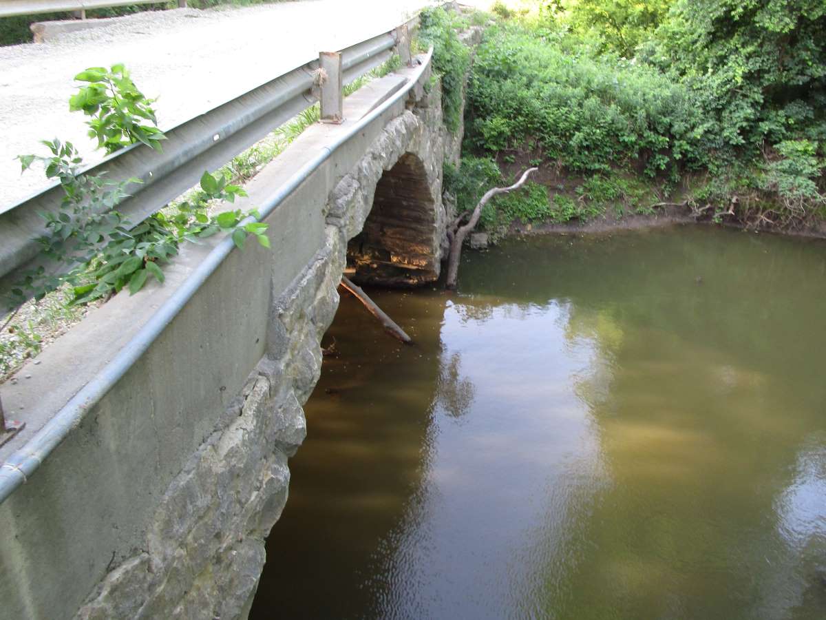
Peter Johnson’s Bridge
- Where: Located just down the embankment on the north side of Quito Road, a short distance west of where Quito Road crosses the Little Walnut River, north and east of Leon; this bridge used to span the Little Walnut.
- When: Original arch built in 1895, the second arch built in 1900.
- Built By: The original arch was built by Sharp Brothers (Walter Sharp and his brothers). The second arch was built by Walter Sharp.
- Spans: One 33′ and one 30′.
- Further Resources: Found: Butler’s Historic Peter Johnson’s Bridge, The History of Peter Johnson’s Bridge.
- Map Number: 2.
- Note: This bridge, the oldest major stone bridge in Butler, is high and dry, but remains in good shape. It is essentially a part of the embankment of the blacktop road on the north side, a short way west of the current bridge over the Little Walnut.

SW 60th Street Turkey Creek Bridge
- Where: Spans Turkey Creek on SW 60th Street, south of El Dorado.
- When: 1913.
- Built By: C. C. Jamison.
- Spans: One 30′, one 20′.
- Further Resources: C. C. Jamison’s 1913 Turkey Creek Bridge.
- Map Number: 3.

Diller Bridge
- Where: On NE Price Road where it crosses the Walnut River, south and west of Cassoday.
- When: 1908.
- Built By: C. C. Jamison.
- Span: One 45′.
- Further Resources: A Record Stone Arch Bridge Span in Butler County, Kansas: The Diller Bridge, Butler’s Three Walnut River Bridges
- Map Number: 4.

Minos West Ford Bridge
- Where: Spanning Hickory Creek on SE Ellis Road, south of Leon.
- Built By: C. C. Jamison.
- When: 1906.
- Span: One 40′.
- Further Resources: C. C. Jamison’s Masterpiece: The Minos West Ford Bridge.
- Map Number: 5.

Cedar Ford Bridge
- Where: On SE Pickrell Road a few feet north of where it crosses Rock Creek. Though this bridge originally spanned Rock Creek, it now carries the road over an overflow channel. The long south approach of the stone bridge joins the 1917 concrete bridge which spans the actual creek.
- When: 1908.
- Built By: C. C. Jamison.
- Span: One 40′.
- Further Resources: The Cedar Ford Bridge.
- Map Number: 6.

NW 130th Street Henry Creek Bridge
- Where: On NW 130th Street, where the road crosses Henry Creek, north of Potwin.
- When: 1910.
- Built By: C. C. Jamison.
- Span: One 40′.
- Map Number: 7.

SE Satchell Creek Road Rock Creek Bridge
- Where: Spanning Rock Creek on SE Satchell Creek Road, southwest of Latham.
- When: 1905.
- Built By: C. C. Jamison.
- Span: One 40′.
- Further Resources: A Classic Butler County Stone Arch Bridge: The Rock Creek Bridge.
- Map Number: 8.

Hill Bridge
- Where: Spans Dry Creek on SW Diamond Road, west of Augusta.
- When: 1912.
- Built By: O. Markley.
- Span: One 40′.
- Further Resources: The Hill Bridge on Dry Creek, Augusta, Butler County, Kansas, Butler County’s Hill Bridge Damaged by Flooding.
- Map Number: 9.
- Note: Due to flood damage sustained in 2025, this bridge is currently closed to vehicular traffic.
Sycamore Springs Bridge
- Where: On NE 140th Street where the road crosses the Walnut River, west of Cassoday.
- When: Construction began in 1899.
- Built By: Abe Matheney.
- Span: One 36′.
- Map Number: 10.
- Further Resources: Butler’s Three Walnut River Bridges.

SW Tawakoni Road Fourmile Creek Bridge
- Where: On SW Tawakoni Road where it crosses Fourmile Creek, near Andover.
- When: 1899.
- Built By: Abe Matheney.
- Span 36′.
- Map Number: 11.

NW 160th Street May Branch Whitewater River Bridge
- Where: Spans the May Branch of the Whitewater River on NW 160th Street, in Clifford Township.
- When: 1906.
- Built By: C. C. Jamison.
- Span: One 36′.
- Map Number: 12.

Wilson Bridge
- Where: Spans Dry Creek on SW 90th street, west of Augusta.
- When: 1899.
- Built By: Walter Sharp.
- Span: One 36′.
- Further Resources: The Wilson Bridge: Walter Sharp’s 1899 Dry Creek Bridge
- Map Number: 13.

Walz Ford Bridge
- Where: Just south of the Rock Creek crossing on SE Bluestem Road, in Clay Township. Though the bridge once spanned the creek, it now carries the road over dry land.
- When: Construction began in 1899; bridge was accepted in 1900.
- Built By: Walter Sharp.
- Spans: Two 18′.
- Further Resources: The Walz Ford Bridge, 4 Lesser-Known Stone Bridges of Kansas.
- Map Number: 14.
Liggett Ford Bridge
- Where: Spans Harrison Creek on SE Price Road, east of El Dorado Lake.
- When: 1903.
- Built By: C. C. Jamison.
- Span: One 30′.
- Map Number: 15.
Grant Bridge
- Where: Spanning Satchel Creek on NE Grant Road, east of El Dorado Lake.
- When: Completed in 1914.
- Built By: C. C. Jamison.
- Span: One 30′.
- Further Resources: The Grant Bridge.
- Map Number: 16.

SW Walnut Valley Road Cave Spring Branch Turkey Creek Bridge
- Where: Spanning Cave Spring Branch of Turkey Creek on SW Walnut Valley Road, south of El Dorado.
- When: 1910.
- Built By: C. C. Jamison.
- Span: One 30′.
- Map Number: 17.

Nuttle Turkey Creek Bridge
- Where: Spans Turkey Creek on SW 70th Street, near El Dorado.
- When: 1897.
- Built By: Abe Matheney.
- Further Resources: The 1897 Turkey Creek Bridge.
- Span: One 25′.
- Map Number: 18.

SW 230th Street Polecat Creek Bridge
- Where: Spans Polecat Creek on SW 230th Street, south of Rose Hill.
- When: 1901.
- Built By: C. C. Jamison.
- Span: One 24′.
- Further Resources: The Polecat Creek Bridge.
- Map Number: 19.

Old Kentucky Creek Bridge
- Where: Located high and dry in the road embankment of the blacktop Flinthills Road, about a mile north of Flinthills Road’s intersection with SE 70th Street. The bridge is located just south of the current crossing of the small creek known historically as Kentucky Creek.
- When: Bids called for in late 1910.
- Span: One 24′.
- Note: This bridge is largely filled in, but a fair amount of it remains visible above the surface of the ground. This structure was built by Rosalia Township, as opposed to the county proper. Visitors should be aware that this bridge crosses over into private property, though much of it is within the road easement, so please mind the fences.
- Further Resources: Another Major Stone Bridge Found in Butler County.
- Map Number: 20.

SW Santa Fe Lake Road Gillion Creek Bridge
- Where: Spans Gillion Creek (Fourmile Creek) on SW Santa Fe Lake Road, south of Potwin.
- When: 1901.
- Built By: Abe Matheney.
- Span: One 22′.
- Map Number: 21.
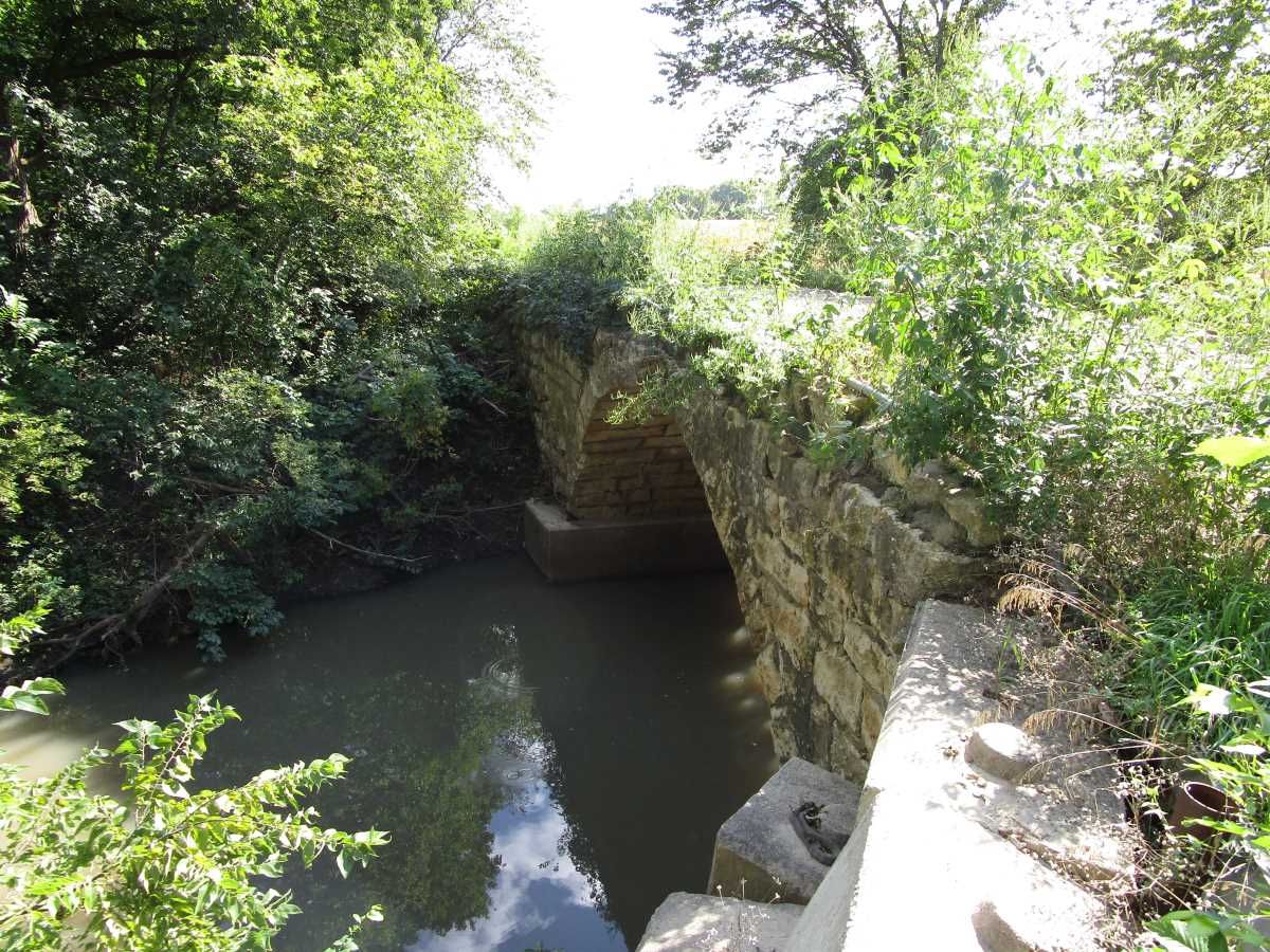
Thomas Jefferson Smith Ford Bridge
- Where: Where SE Summit Road spans the north branch of Hickory Creek, southwest of Beaumont.
- When: 1906.
- Built By: Abe Matheney.
- Span: One 20′.
- Map Number: 22.

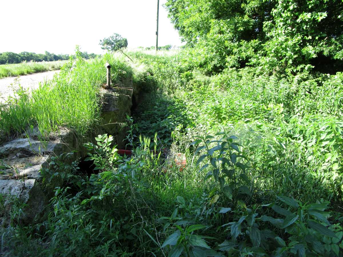
Section 9 Rosalia Township Culvert
- Where: Carries Cattlepen Road over a gully in Rosalia Township.
- When: 1915.
- Built By: C. C. Jamison.
- Span: One 10′.
- Further Resources: Two New Additions to Our List of Stone Bridges of Butler County, Kansas.
- Map Number: 23.

NW 115th Street Whitewater River Bridge
- Where: On NW 115th Street where the road crosses the Whitewater River, north of Potwin.
- When: 1907
- Built By: J. H. Higdon and S. R. Poe.
- Span: One 16′.
- Further Resources: Another Lesser-Known Stone Arch Bridge: Whitewater River Bridge.
- Map Number: 24.

Augusta Township SW Diamond Road Culvert
- Where: Carries SW Diamond Road over a small channel near Augusta. The culvert is located roughly halfway between Diamond Road’s intersection with SW 60th Street and Diamond Road’s intersection with SW 70th Street.
- Note: This culvert has been widened with a cement arch culvert on both sides. As a result, it looks like a concrete culvert from the outside. The stone arch section is intact within the culvert.
- Further Resources: A New Addition to the Stone Arch Bridges of Butler County List.
- Map Number 25.
Glencoe Township SE 80th Street Culvert
- Where: Carries SE 80th street between a short distance west of the road’s intersection with Tallgrass Road, over a ditch.
- When: Construction underway in late 1905.
- Probable Builder: Harry Brickley.
- Further Resources: Two New Additions to Our List of Stone Bridges of Butler County, Kansas, Investigating the Glencoe Township Stone Culverts Part 1, Investigating the Glencoe Township Stone Culverts Part 2.
- Map Number: 26.

Glencoe Township SE 90th Street Culvert
- Where: Carries SE 90th street over a small ditch between SE 90th’s intersection with SE Munson Hill Road and SE 90th’s intersection SE Satchell Creek Road; the culvert is approximately halfway between the two intersections, though a little closer to SE Munson Hill Road than SE Satchell Creek Road.
- When: Contract let 1906.
- Probable Builder: Harry Brickley.
- Span: One 6′.
- Further Resources: More Butler County, Kansas, Stone Culverts, Investigating the Glencoe Township Stone Culverts Part 1, Investigating the Glencoe Township Culverts Part 2.
- Map Number: 27.
Glencoe Township SE 80th Street Culvert (2)
- Where: Carries SE 80th Street over a small, obscure ditch a short ways east of SE 80th’s intersection with SE Munson Hill Road.
- Note: The culvert is nearly filled in with sediment, though it still carries a small amount of water.
- Further Resources: More Butler County, Kansas, Stone Culverts, Investigating the Glencoe Township Culverts Part 3.
- Map Number: 28.

Glencoe/Little Walnut Township Line SE Price Road Culvert
- Where: Carries SE Price Road over a small ditch barely north of SE Price Road’s intersection with SE 70th Street; the culvert is also visible from SE 70th Street.
- Further Resources: More Butler County, Kansas, Stone Culverts, Investigating the Glencoe Township Culverts Part 3.
- Map Number: 29.
- Note: This culvert has been widened on one side.

Little Walnut/Logan Township Line SE 120th Street Culvert
- Where: Carries SE 120th Street over a ravine west of 120th’s intersection with Teter Road; the culvert is roughly 3/4 of a mile or so from the Teter/120th intersection.
- When: Construction underway in 1913, fill added in 1914.
- Built By: James S. Kiser.
- Further Resources: James Kiser’s Culverts: Newly Found Butler Stone Culverts.
- Map Number: 30.
Little Walnut/Logan Township Line SE 120th Street Culvert (2)
- Where: Carries SE 120th Street over a small ravine a short distance west from the Little Walnut/Logan Township Line SE 120th Street Culvert listed above; these structures span two separate ravines that are notwithstanding near each other.
- When: Construction underway in 1913, fill added in 1914.
- Built By: James S. Kiser.
- Further Resources: James Kiser’s Culverts: Newly Found Butler Stone Culverts.
- Map Number: 31.

Little Walnut Township Teter Road Culvert
- Where: Located on Teter Road, at the edge of the road roughly halfway or so between Teter’s intersections with SE 120th Street and SE 110th Street.
- Map Number: 32.
- Further Resources: A Partly Buried Little Walnut Township Stone Culvert.
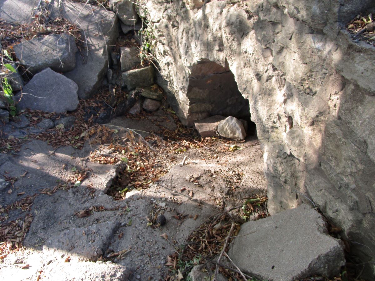
- Note: This culvert no longer is used by the road; the road crosses the channel to the south. Most of this old stone bridge is located within the road right-of-way and is located on the edge of the road. The road edge of this culvert is mostly filled in; for that reason it is substantially larger than what the photo would indicate. It appears to be built along the same lines as #27 (Glencoe/Little Walnut Township Line SE Price Road Culvert) above. Visitors should be aware that one end of this structure is on private property, so please mind the fences.

5th Street Towanda Culvert
- Where: Located in Towanda, on 5th Street between 5th’s intersections with Pool and Cincinnati streets.
- When: 1909
- Built By: J. E. Dwyer.
- Map Number: 33.
- Further Resources: A Butler County Stone Bridge in Towanda.
Towanda Township Fulton Road Culvert
- Where: Located on Fulton Road in Towanda Township, spanning a small channel just south of where Fulton Road crosses the Kansas Turnpike.
- Map Number: 34.
- Further Resources: A Butler County Stone Culvert Find in Towanda Township.
- Note: This culvert has been extensively built up with concrete curbing and also has been modified with the addition of concrete wing walls. The original portion was widened with another stone arch type structure.

Towanda Township 10th Street Culvert
- Where: Located on 10th Street, east of 10th’s intersection with Hunter Road.
- Map Number: 35
- Further Resources: A Tiny Butler County Stone Culvert.
- Note: This tiny stone culvert has been given large cement curbings on top, which makes it look like a concrete bridge at a casual glance (but which makes it easy to spot). This culvert has been widened, but in this instance the widened section is also a stone arch which was butted up against the original section.

Augusta/Towanda Township Line Culvert
- Where: Spans a ditch on 60th Street a short distance west of 60th’s intersection with Buffalo Road.
- Map Number: 36.
- Further Resources: Butler County’s Gothic Stone Culvert.
- Note: This culvert has been widened on one side in two installments.

Latham Young Street Culvert
- Where: Located in the town of Latham, this culvert spans a small ditch on Young Street, between Young’s intersections with Cherry and Walnut.
- When: Likely 1887.
- Map Number: 37.
- Further Resources: Three Significant Butler County Stone Bridge Finds.

Latham Blaine Street Culvert (1)
- Where: Located in the town of Latham, this extremely wide culvert carries Blaine Street/SE 200th Street, Latham’s main road, over a ditch. The culvert is located just west of the Post Office.
- When: Likely 1891.
- Map Number: 38.
- Further Resources: Three Significant Butler County Stone Bridge Finds.
- Note: This culvert can be seen, but is heavily obscured by widening on both sides with concrete structures. The stone arch section is very wide, and shows signs that the original stone arch bridge was widened at some point with an additional stone arch section.

Latham Blaine Street Culvert (2)
- Where: Located in the town of Latham, this culvert carries Blaine Street/SE 200th Street, Latham’s main road, over a ditch. The culvert is located just at the west side of the Hickory/Blaine Street intersection.
- When: Likely circa 1887.
- Map Number: 39.
- Further Resources: Three Significant Butler County Stone Bridge Finds.
- Note: This culvert has been widened on one side with a concrete structure.

SW 20th Road Access Culvert (Towanda Township)
- Where: This abandoned structure spans a road side ditch on the section of SW 20th Road between Ohio Street and Hunter Road. It appears to have formerly provided vehicular access to a house.
- Map Number: 40

Towanda High Street Access Culvert
- Where: Located at the west end of High Street in Towanda; this culvert spans a road side ditch to provide vehicular access to a house.
- Map Number: 41.
- Note: This culvert likely was once a road culvert for a now abandoned section of 2nd Street in Towanda.

Fairview/Towanda Township Line Culvert
- Where: Located on a dead-end section of Parallel Street east of where Parallel intersects Santa Fe Lake Road.
- When: 1899.
- Built By: W. H. Harden and Milton Baker.
- Map Number: 42.
- Further Resources: A Fairview Township Culvert.
- Note: This small culvert has been widened on one side with a newer structure. It is significant for being the only known remaining Fairview Township stone arch culvert.

Augusta Township SW 110th Street Culvert
- Where: Located near the end of a dead-end section of SW 110th Street, west of SW 110th’s intersection with Thunder Road, just outside Augusta.
- Map Number: 43.
- Further Resources: An Augusta Stone Arch Culvert.
- Note: This stone arch culvert has been widened on both sides with a concrete arch.

Also In Butler….
Brainerd Bridge
- Where: Spans Dry Creek near Brainerd. The bridge formerly carried Indianola Road, but this section of road has been abandoned. Private property.
- When: Completed 1903.
- Built By: C. C. Jamison.
- Note: This bridge is not visible from the public roads.
