While at Towanda recently, we discovered two small stone arch culverts at the roadside. These structures proved to be a unique case, as they were both vehicular access culverts, rather than full-out road culverts. One, now abandoned, is completely within the easement of the blacktop SW 20th Street. The other is in Towanda, and formerly carried 2nd Street. Now, however, it is an access culvert, due to the abandonment of the street, and is neatly located over a small stone-lined drainage ditch at the edge of High Street between the street and the sidewalk.
The SW 20th Street Culvert
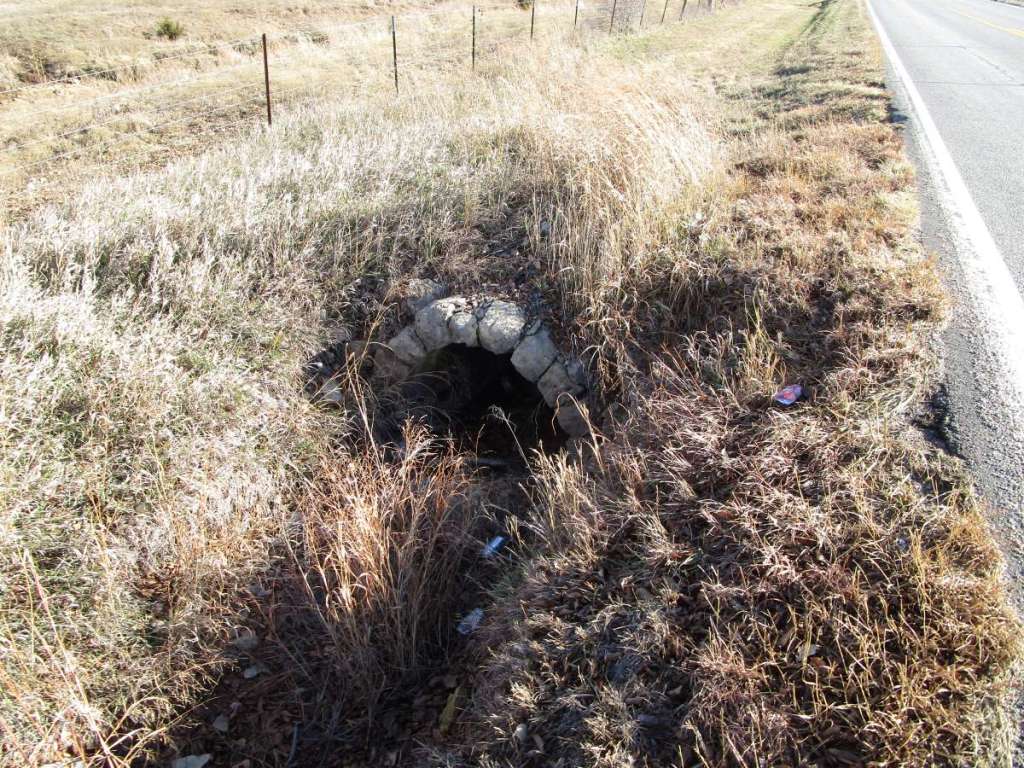
The stone arch culvert off of SW 20th Street is a unique structure, featuring small rough stones, and a rather crude design. Totally overgrown with grass, the arch is still visible, though slightly damaged on one side, while the spandrels are largely collapsed.

A look at a 1905 plat map suggests that it may have been intended as access for a house, now gone. Old newspapers show that individuals in several instances paid to have a stone arch bridge built in connection with their property in Butler and Cowley. Also, undoubtedly, some landowners simply built their own structures. While it is hard to guess how many of these privately built stone arch bridges were built or remain, it would appear that the 20th Street culvert is a unique surviving example. This structure is accessible to the public. This culvert has been added to our Butler bridge map, number 38.
The 2nd Street Towanda Culvert
The stone arch access culvert located at the corner of High and Second streets in Towanda is a small structure, and, interestingly, resembles not the 5th street stone culvert also in Towanda, but the old portion of the SW 10th street culvert (map number 33) we found last year in Towanda Township. Probably the 2nd and 5th street culverts were built by different people, though no newspaper evidence has turned up yet referring to the 2nd Street culvert, though the 5th Street one is well documented. There can be but little doubt this small structure was a road culvert; now it is primarily access to a house.
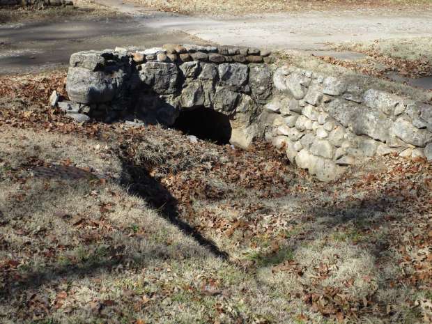
Though this culvert is located between the road and sidewalk and publicly accessible, people viewing it should be respectful of the nearby house owners. It is easily photographed from High Street. This culvert has been added to our Butler bridge map, number 39.
